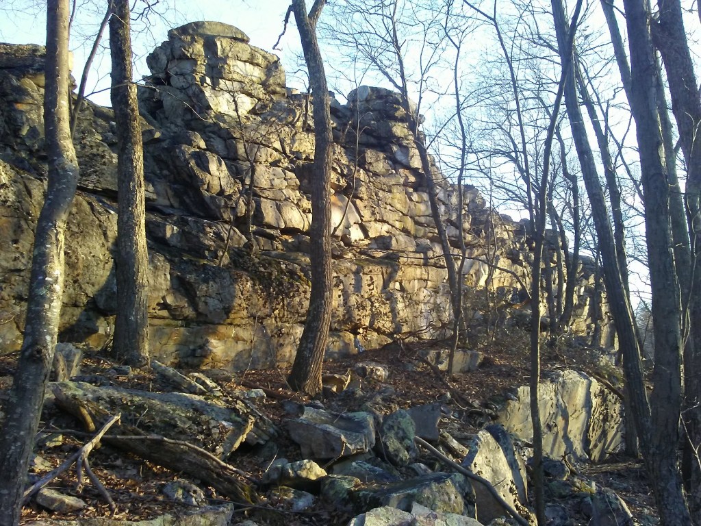
One of my go-to hikes in our area is a very moderate walk south along the top of Sleepy Creek Mountain toward a spot called High Rock. You get a lot of view from this short-ish out and back hike (4 miles). The destination has towering rocks, and a manageable ledge that affords a sweeping view of the West Virginia-Virginia border and thousands of acres of public land.

Along the way, there are views to the west — of Cacapon Mountain — and of the parallel ridge to the east. (That ridge leads to Pee Wee Point, another favorite destination.)
The trail to High Rock is entirely in Sleepy Creek Wildlife Management Area and follows the Tuscarora Trail on a dirt track road that turns south off Shanghai/Hampshire Grade Road just at the crest of Sleepy Creek Mountain. The dirt track can be driven — by the right sort of vehicle — when the gates are open during hunting season. More often than not, there’s a big tree or two down somewhere along the stretch that will stop you from driving the whole way. Go by foot and a few fallen trees don’t matter a bit.
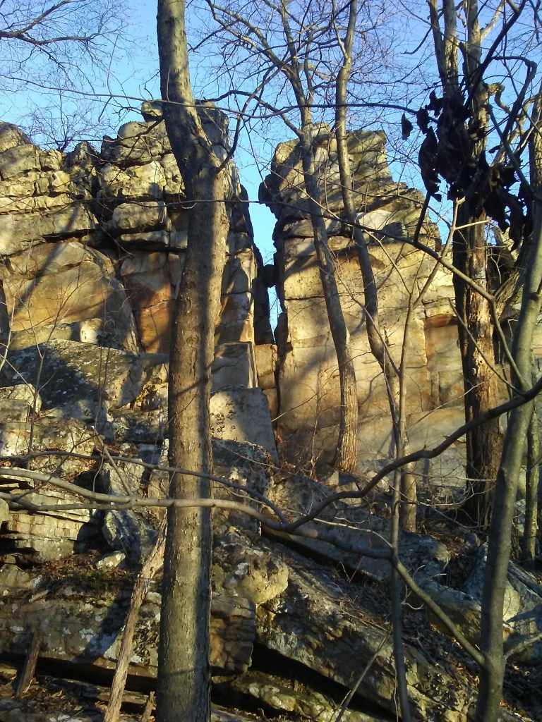
Boulder outcroppings along the trail give a little preview of what you’ll find when you reach High Rock. You’re seeing the rocky remains of the crest of Sleepy Creek Mountain, which stretches for 23 miles almost entirely within Morgan County — from Spruce Pine Hollow along WV Route 9 to Shockey’s Knob at the Virginia border.
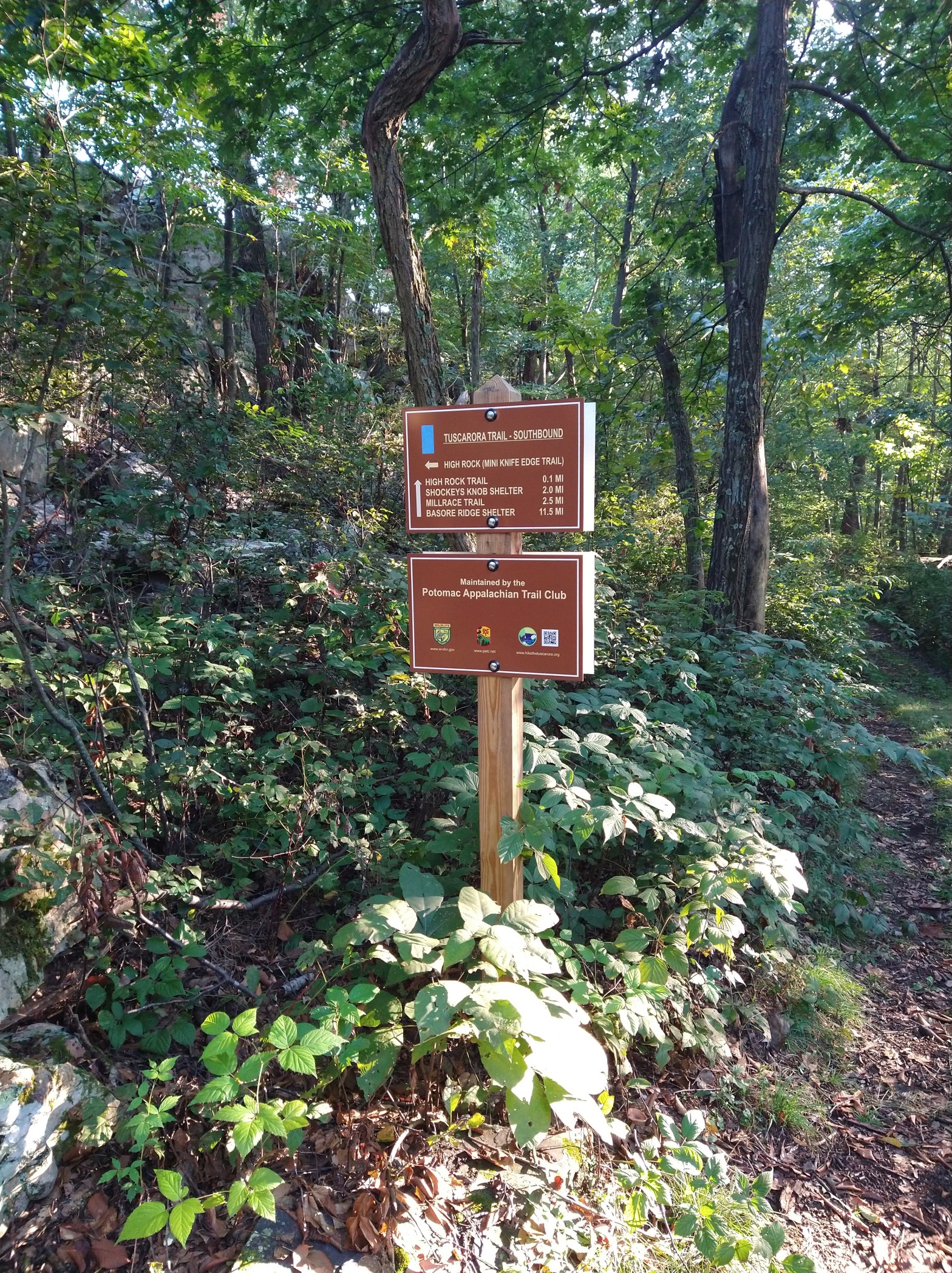
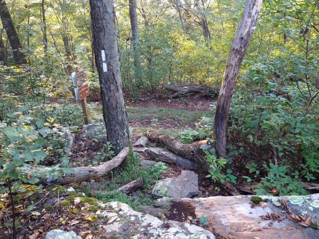
Potomac Appalachian Trail Club maintains the trails associated with the Tuscarora Trail, and has put up new signs in recent years to guide hikers. As you approach the towering High Rock, look for the sign on the left that marks the small side trail to the overlook view.

Layers of rock form a sort of natural stairway up, but it’s irregular so pay attention to your footing, especially in winter (ice) and summer (snakes).
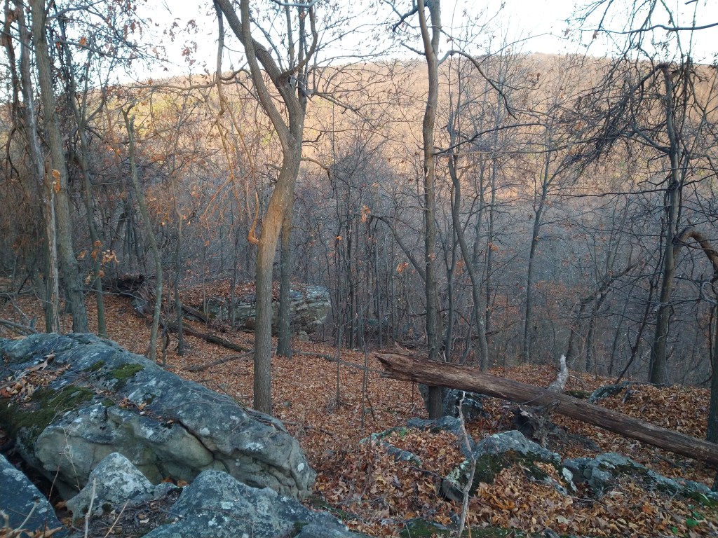
One of the things that draws me back to the same trails and overlooks is that they change from season to season. In summer, the view from High Rock is lush and green, and a little obscured by bushes and leafy trees. Fall color in the valley below is rich. In spring, that particular bright green of new leaves and pink of buds is painted all over the ridges and valley. Winter offers less color, but a better topographical view…the shapes of mountains and ridges are clearest then.
There’s a substantial drop from the rocky ledge that affords the best view of the Back Creek Valley, and Virginia to the south. Down below, the mountain drops to the valley bottom where another trail runs…check maps of Sleepy Creek Wildlife Management Area if you want to explore that from the Brush Creek Access parking lot.
Past High Rock, a side trail of the Tuscarora drops east, down into the valley. Or you can continue south on the Tuscarora (blue blaze) toward the end of Sleepy Creek Mountain at Shockey’s Knob, if you’re feeling energetic or can get a ride home from the southern end of the mountain.
If High Rock is your destination, there’s plenty to enjoy there…from the valley view to the east to the rocks themselves. Look for the ferns that like to sprout on the west side of the rocks. Kids and climbers like to scramble on the boulders, too, if the conditions are right.
Whether your feet take you further along the Tuscarora Trail, down into the valley or back to your starting point, a hike to High Rock is good in any season. That I know for sure.
